Friday, July 29, 2016

Muskrat Lake, Ontario

a tree-filtered glimpse of Muskrat Lake
2,618 miles

whitewater rapids on the Ottawa River
July 29 - The Ottawa River in this area is full of whitewater rapids, so traditional canoe travel was impossible.   

Algonquin family with transport canoe
The native Nibachis, an Algonquin-speaking tribe, and the first French explorers, including Samuel Champlain, followed a 13-mile portage route from east of the Roche Fendu set of rapids, overland to the southeastern end of Muskrat Lake (now Cobden),  and then using the Muskrat River system to continue to Mirimichi (now Pembroke). Later, lumbermen also used this route.  

Muskrat Lake shortcut

The Government of Upper Canada commissioned the famous surveyor and explorer David Thompson to find out whether a canal route was feasible, but did not proceed with that idea.  Then a private entrepreneur, Jason Gould, set out to build “Gould’s Line”, which combined overland and lake travel along that same route.

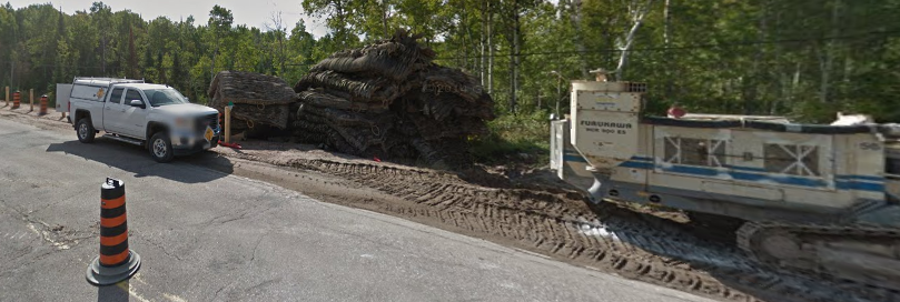
"corduroy road" of logs

A rough “corduroy road” made of logs was laid out from the lake to the Ottawa River below Calumet Island, along which stage wagons carried freight and passengers.  Row boats on Muskrat Lake conveyed passengers and goods to Pembroke, replaced later by a small steamboat.  When the line was complete in the 1850s, the entire trip – from Ottawa  to Rapides des Joachims and  back – could be accomplished in three days.


Ottawa River steamship, 1868
In 1868, a steamship company published a brochure titled “Tourists and Travelers Guide to the Upper Ottawa” and in 1984 a local historical article, written by Clyde C. Kennedy and published in the Pembroke Observer, summarized the description of this mid-Victorian mode of deluxe travel:

First class omnibuses left the various Ottawa city hotels every morning during the week to connect at Aylmer with steamers leaving the place upon the upward voyage at 8:30 a.m. The passengers enjoyed the novelty of eating each meal during the day on a different vessel. They breakfasted on board the “Ann Sisson” shortly after leaving Aylmer, dined upon the “Alliance” and had tea in the course of the trip from Cobden to Pembroke on the “Jason Gould” or “North Star“.


Around 1916, a cryptid creature was seen in Muskrat Lake, and folktales began circulating about the water monster.  It was described as “having three eyes, three ears, one big fin halfway down its back, two legs, [and] one big tooth in front, is silvery-green in colour, and stretches for twenty-four feet.” It was likened to the Loch Ness Monster of Scotland, and was thus named “Mussie”.

The creature has become a tourist attraction and a cultural mascot of the area, much like Paul Bunyan or Cordwood Pete (March 1 – Fosston, Michigan).  Mussie is portrayed on signs welcoming visitors to Cobden and by a statue (with only 2 eyes) in front of the hardware store in the village.

The statue of Mussie is given seasonal accessories to mark holidays, like reindeer antlers & a Rudolf red nose for Christmas.
Visitors to Muskrat Lake search for Mussie in the lake, but no one has captured evidence of its existence.


Muskrat Lake's ecology encourages the growth of underwater weeds that can entangle swimmers and boat propellers.  Visitors flock to the lake to catch impressive pike, walleye, pickerel, and lake trout, even though eating the fish is not recommended due to high levels of phosphorus and green algae in the water.


info & images:
Wikipedia.org
Google Images

Sunday, July 24, 2016

Forest Lea, Ontario

2,603 miles


July 24 – This crossroads is a “rural community” within an administrative conglomeration of such settlements.  The surrounding woods seem to be full of cross-country ski trails. 


Forest Lea itself seems to be no more than a exurban housing development with a romantic name.  There’s no evidence of a town center or any historical remains.  The large houses seem recently built.  

In my Google Street Views exploration of this crossroad, I found myself following this iconic yellow bus driving on the highway.  The school-age children of Forest Lea are bussed to schools in the Ottawa River-side town of Pembroke.

Thursday, July 21, 2016

Messer Trail, Chalk River, Ontario

L to R:  Messer Trail, RR tracks, Highway 17, power transmission lines
2,588 miles

July 21 – Several lines run parallel to the highway here.  The Ottawa River has always been the main thoroughfare through the region, but there would have been trails through the forest, too.  A railroad track was built roughly parallel to the river, but much straighter for technological convenience.  And subsequent transport seems to have followed the railroad tracks pretty closely.  The Trans-Canada Highway.  Power transmission lines from the nuclear power plant and the hydro-electric generation dams to the cities. 

Next to the railroad tracks next to the highway is a trail that connects parts of the towns of Chalk River and Petawawa, called the Messer Trail.  Several hiking websites list all of the recreational trails in Ontario, but I haven’t been able to find out any information about this trail or the derivation of its name.  

Messer Trail borders on – or is part of – a military base, and the one mention of it that I found is a call for contractor bids to pave the trail and provide parking lots at the ends.  That plan sounds like it will become a civilian recreational trail (hiking & biking, not snowmobile).  No one in the town answered my inquiry. It remains a mystery to me.

The local area has several interesting road names (Totalize Road, Veritable Road).  The numerous “crossings” suggest a time when railroads or forest trails covered the region. 
Duke Crossing (Orange Road)
Stewart Crossing (Totalize Road, Black Bear Road)
Brindle Crossing (Veritable Road, Brindle Road)
Old Road Crossing
Midway Crossing

Tuesday, July 19, 2016

Laurentian Hills, Ontario

2,573 miles

July 19 – This town shared the history of its region, from Algonquin tribes and Iroquois raiders to French voyageur fur traders, loggers, struggling farmers, and then city folks bringing an increase in summer cottages and outdoor recreation along the river.  

In the year 1902, the first hydroelectric dam was built on the Ottawa River to modernize the lives of the people. 

In September 1944, during World War II, some Government men came to the area and spent the next week and a half studying the river depths and currents.  Soon after, the government announced that His Majesty the King (George VI of England & Canada, etc.) had appropriated the nearby township of Buchanan for a vital wartime project.  Residents learned that they were being expropriated from their land, and they left town forever the following year.  Most of the residents did not have the means to start again from scratch, so they dismantled their buildings and transported them elsewhere.  Today, many of the historic remains of the relocated residents lie quietly within the boundaries of the nuclear research facility.

used & abandoned Hanford High School
This story reminds me of the history of my own birthplace, Hanford, Washington.  To build the atomic bomb factory to end World War II, the US federal government shut down the agricultural town of Hanford and sent its residents away.  Residents were given a 30-day eviction notice on March 9, 1943.  Most buildings were destroyed, except the high school, which was used during the war as an office building.  I was born on the military base on the nuclear reservation after the war ended, but I claim the former town of Hanford as my birthplace.

CANDU reactor design
Since the 1950s, when nuclear energy was developed for peace-time electric power generation, this Ontario town has been the home to the Nuclear Power Demonstration, the first Canadian nuclear power reactor.  The NPD was the prototype and proving ground for research and development that led to commercial application of the Canadian “CANDU” system for generating electric power from a nuclear plant.   The CANDU acronym refers to its Canadian-developed design using heavy water (deuterium-oxide) and uranium fuel.  CANDU reactors were first developed in the late 1950s and 1960s by a partnership between Atomic Energy of Canada Limited (AECL), the Hydro-Electric Power Commission of Ontario, Canadian General Electric, and other companies.  All power reactors built in Canada are of the CANDU type.

CANDU workers in hazmat suits
Many of the 2,800 residents of the township are employees of the nuclear reactor facility.  They are scientists and engineers and hazardous materials technicians.

In the year 2000, the Town of Laurentian Hills was created by merging the administration of several depopulated towns in the area.  It was then named not for any vestige of local history but for the scenic hills visible across the river in Quebec.  At least, those hills are visible from the nicer houses on the banks of the Ottawa River.

community hockey rink & fun center
The center of town consists of a snowplow garage, a municipal building, a fire station, and an outdoor hockey rink.  In the 6-month season of non-winter, such as the day Google Street Views took their pictures, the hockey rink looks neglected and derelict.  But there are signs of lively community enjoyment: a meeting facility, snack concession stand, children’s play structure, plus basketball hoops for non-ice season practice. 

As I “drove” around the local roads via Google Street Views, I saw evidence of people’s preparation for fierce winters.  Almost every house had an open woodshed full of neatly stacked firewood.


info:  Wikipedia.com
Algonquins to Atoms Along the Ottawa:  http://www.nuclearfaq.ca/ottawa.htm

images:  Google Images

Thursday, July 14, 2016

Driftwood Bay, Ontario

driftwood in the bay
2,558 miles

July 14 - This sheltered bay on the Ottawa River was created in 1950, when the construction of the Des Joachims hydro-electric dam 12 km downstream blocked and enlarged this section of the river.  The reservoir lake is named Holden Lake.  This modern bay is a place where driftwood floating downstream settles and washes ashore, especially in the springtime.

The Driftwood Provincial Park is a popular summer destination for campers who enjoy hiking, swimming, canoeing, and fishing in the river.   Although the park is gated in the winter, people can enter on foot for hiking, cross-country skiing and snow-shoeing. 

Driftwood Park: cleared hiking trail
The hiking trails offer pleasant views of the Laurentian Mountains across the river in Quebec (named for St. Laurent of the regional River and Seaway).  They range over  rocky ridges and eskers.


An esker is a long, winding ridge of stratified sand and gravel formed by Ice Age glaciers in Europe and North America.  Spectacular examples can be seen in Ireland, Sweden, and Alaska.  

esker example (Manitoba)
Eskers are frequently several miles long and, because of their peculiar uniform shape, are somewhat like sinuous railway embankments.  The eskers at Driftwood Park are small examples, and not easily photographed, but interesting nonetheless.


trailside bunchberry

info:  Wikipedia.com


images:  Google Images

Friday, July 8, 2016

Bissett Bay, Ontario

2,543 miles

July 8 - Bissett Bay is a wide place in the Ottawa River where the Trans-Canada Highway skims along the edge of the river.

A little farther on is a wide place in the road that gives a hint about winter weather conditions here.


images:  Google Street Views

Friday, July 1, 2016

No-Name Woodlands, Ontario

gated, locked, and posted
2,528 miles

Along this stretch of Highway 17, the Trans-Canada Highway, I found no place names, no nearby landmarks, no crossroads.  I saw a few farmhouses.  I saw many gated entrances to dirt roads, and I wondered whether they were very private homes or cabins or undeveloped land that is reserved for hunting.  The aerial view does not provide much information about the lands behind the gates.

The most intriguing features around here are the short gravel roads to nowhere.  They seem to cross the highway’s drainage ditch and then stop.


road construction east of Corbeil, ON
I thought I was pretty clever to deduce that they were staging areas for highway construction, such as what I saw on Google back in Corbeil.  
I wonder: do many stretches of highway contain these?  Maybe only in such a featureless stretch are they so noticeable.


Tractor needs a causeway.
The most practical reason for these short little roadlets would be for tractor access to the fields across the drainage ditch.  That’s what I’m going to believe, unless I hear from a more knowledgeable reader.


images:  Google Images & Google Street Views