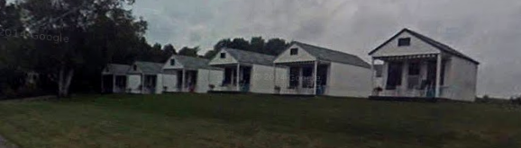
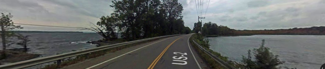
Monday, November 21, 2016

Colchester, Vermont

2,901 miles

Nov 21 – Colchester is a comfortably prosperous suburb of the city of Burlington, Vermont's most populous city.  The town is directly to Burlington's north on the eastern shore of Lake Champlain.  The westernmost part of the town touches the New York state border in the middle of the lake.  To the northwest across the eastern arm of the lake lies the town of South Hero.

The population of Colchester is about 17,000 people.  At night, it is the second most populous town in the state of Vermont, but the daytime weekday populations of Burlington and Montpelier are greater when suburbanites commute into the working cities.

Vermont is the second whitest state in the Union, second only to Maine.  In a 2013 US Census estimate, 94% of the population identified as white but not of Hispanic or Latino origin.  The racial makeup of the town of Colchester is 97% white and 2% Asian.

Indian Brook
Along my route, in addition to predictable New England town place names like Mill Pond Road, Orchard Road, and Poor Farm Road, I see Indian Brook and Indian Brook Road.  Other references to the natives who once lived here may also include the nearby Discovery Road and the poignant Lost Nation Road.  I’ve encountered many Vermont brooks named for the otters or beavers that used to live there.  Occasionally the native “Indians” are referenced.  But for the most part, each town’s history begins in the 1760s when American land grants and town charters were given.  Some mention may be made of the French and Indian Wars, especially here in the north, but then the natives disappear from the accounts.  I surmise that many of the tribes were wiped out during the early contact plagues of European diseases.  That must be how European-Americans were able to move into the wilderness here to establish towns without significant native resistance.

Malletts Bay
During the times of uncertain sovereignty of this land, there were also French Canadians scattered through these woodlands.  In Colchester, there was an old Frenchman known as "Captain Mallett" living in the area at the time of the town’s charter in 1763.  He managed to survive during the international and inter-ethnic hostilities of the French and Indian Wars, and the remains of his house were still visible into the 1800s.  Today his legacy is in the name of Malletts Bay, with its marinas, summer residences, and campgrounds.

The most modern and luxurious homes are built around Malletts Bay now, but my route takes me through the old center of the village, where the library and the Colchester Historical Society are located.


Burnham Memorial Library
The Colchester library started in 1900 when a few women collected 47 books and began renting rooms above Wolcott's store on the corner of Main Street and Mill Pond Road, very close to today's library location.  It was very popular.

Etta & Herbert Burnham
In 1911, the town officially assumed responsibility for the library and its upkeep, naming it the Colchester Free Library.  In 1939, Electa ”Etta” Burnham left much of her estate for the purpose of erecting a dedicated library building with a larger collection.  The new Burnham Memorial Library was built in 1942, and an addition was added in 1989 with funds raised by the Friends of the Library.  Today the library houses more than 54,000 materials and has an annual circulation of approximately 120,000 items.


cliff jumping in abandoned quarry
Another feature of many Vermont towns is an abandoned stone quarry.  Colchester’s old quarry has filled with water, and it has gained a reputation around the region for its deep water under straight cliffs.  Although access to the quarry is forbidden, a hole has been cut in the fence and teenagers enjoy jumping from the cliffs into the water hole for a thrill.  Websites have been created and videos have been posted.  Even though it reminds me of my cousin who was paralyzed in a diving accident, this secret diving does look like a lot of fun.  I imagine generations of Colchester teenagers carrying on the tradition.


info:  Wikipedia.com

images:  Google Images


Friday, November 18, 2016

Sand Bar State Park, Vermont

photo by Danielle Austen
2,891 miles

Nov 18 – Sand Bar State Park is a natural, triangular sandbar between South Hero Island and the town of Milton on the mainland.  Over tens of thousands of years, the Lamoille River washed sediment downstream into Lake Champlain.  The river-borne material sank to the bottom as the river emptied into the lake, eventually filling the lake to create marshland and the sandbar.  Natural lake depths here, without the sandbar, would be over 150 feet, but with the sediment, water depth is now only a couple of feet.  When spring runoff raises the water level in the lake, much of the park can be underwater.

no bird pics
from this bird-watching reserve
Additional marshland south and east of the park is part of the Sand Bar Wildlife Refuge, established in 1920.  Its 1,000 acres are home to beaver, muskrats, raccoons, and turtles.  Migratory waterfowl use it as a seasonal stopover and a nesting area.   Many of Lake Champlain's fish use it as their spawning grounds.  Hunting, fishing, and trapping are – of course – not allowed on refuge land.  Bird-watchers are welcome, but they don’t seem to carry cameras.  Or maybe they just don’t post their pics.

Because of the shallow water here, the route along the sandbar served as a ford from the mainland to the Hero Islands long before construction of the first bridge in 1850.  Crossing that first toll bridge, built of rock, gravel, and logs laid corduroy-fashion through the marsh and along the bar, must have been an adventure!  It was often flooded and always needed major repairs after damage caused by shifting ice each spring.  

icewaves, by Randy Abair
Today's wider, higher causeway was completed in 1959, but crossing it can still be scary when snow blowing across the frozen lake blocks visibility, or spray and water from crashing waves washes across the highway during storms when the lake is high. 

The road across the causeway was part of the Theodore Roosevelt International Highway, a transcontinental “auto trail” route through the United States and Canada that ran from Portland, Maine, to Portland, Oregon. It was designated a memorial to Theodore Roosevelt after his death in in 199, and the name was used during the 1920s and 1930s, until numbered routes prevailed.  Its length was about 4,060 miles (6,530 km).

CCC-built stone bathhouse, 1935
The park is on the eastern end of the sandbar.  Sand Bar State Park was established in 1933, and its roads and buildings were built by workers in the Civilian Conservation Corps.[1]  At first it was primarily swampy marshland, which crews of the CCC cleared, filled, and graded.  CCC workers built a stone bathhouse and a stone grill which still stand in the park.  The upper level of the bathhouse was originally used as living quarters for caretakers and lifeguards, but is now used for storage, while the rest of the structure, only modified to provide electricity and plumbing, continues in its original use.

The original 10-acre park included a small campground on the south side of the highway.  As U.S. 2 became a busier and faster road, camping that close to it, and crossing back and forth, was neither desirable nor particularly safe.  In 1970, a land swap gave the former campground, now a fishing access area, to the Fish and Wildlife Department.  The useable length of the beach was doubled and the picnic area, newer bathhouse, and long parking lot were built as the park expanded east onto land acquired from the refuge.

The park's 2,000-foot stretch of sand is considered one of the best beaches on Lake Champlain, and one where the water tends to stay a bit warmer than other parts of the lake in midsummer.  Its smooth, sandy lake bottom remains shallow well out from shore, making this a perfect swimming spot for young children.

The park offers picnic tables with cooking grills, a food concession stand, volleyball courts, horseshoes, canoe and kayak rentals, and a swing set with a gorgeous view of the lake.  Sand Bar is also high on the list for windsurfers and kite surfers, who can be seen whipping around the lake when the wind is up.  All of these attractions combine to make Sand Bar the most visited day park in the state.

The park is open from Memorial Day Weekend through Labor Day Weekend, from 10:00 a.m. to “official sunset”.  I guess I can only be here virtually in November.

info:  Wikipedia.com

images:  Google Images


[1] The CCC was a nationwide public works program created during the Great Depression of the 1930s to provide jobs and training for thousands of unemployed men.  

Tuesday, November 15, 2016

Grand Isle, Vermont

1776 map of Grand Isle
2,881 miles

Nov 15 – Today I learned that these islands named for patriotic heroes (Ethan Allen and his brothers and the Green Mountain Boys who defended Vermont’s independence) were also part of a land grant to Allen and his brother.  The earlier French explorers had named this island Grand Isle, but early Americans called them the Two Heroes.  In 1798, Two Heroes was divided into North Hero (the entire north island), and the towns of Middle Hero and South Hero, the last two sharing the southern island and a representative to the legislature.  In 1810, the town of Middle Hero was given complete autonomy and renamed Grand Isle. 

Round Barn Apartments
Vermont dairy farmers have used innovative round milking barns for more than a century.  North of town, just off of US Route 2, is another example of Vermont practicality and respect for their history.  In 2005, this historic round barn was converted into apartments for low-income old folks.  It offers 24 one- and two-bedroom rental apartments for seniors who want to live independently. Rents are based on household income, and rental assistance is available.  I wonder how many of the residents were farmers, and whether they appreciate this juxtaposition.

Grand Isle Store
What a difference the lake weather makes in Google Street Views images!  The weather on the lake is naturally very changeable, and the day the Google camera car drove through town was gloomy with dark clouds.  Many flags were blown straight in the wind.  At least the Adirondack chairs were not blown across the lawns of the inns.  But the effect of this gloomy weather is to make the town appear less thriving than it may be in fact.  Old postcards and recent photos show sunny summer festivities at the local inns.  This general store (with an adjacent “Billiards” and “Air Hockey” room) looks abandoned with grass in its parking area.  Maybe this effect is seasonal, too.  Maybe this picture was taken in early spring before the tourist season began.

There are about 2,000 people living in the township year-round.  Because it’s the largest town on the islands, its businesses offer most of the practical services needed by all of the island residents, leaving the scenic shoreline to the leisurely vacationers.  

Ferry Watch Inn

On a hill overlooking the western shore of Grand Isle is the Ferry Watch Inn.  The house was built in 1790 with hand hewn timber and wooden pegged joints, using post and beam construction.  The owner was Dr. Simeon Clark who was a paymaster for the US Army.  During the War of 1812 British soldiers invaded this American outpost and searched the paymaster’s house for gold coins.  Dr. Clark had previously buried the gold on the property for safekeeping.  When the British soldiers were unable to find the gold, they took some geese and cooking utensils, and returned to their post on Valcour Island to the west (now New York).

The historic farmhouse has become a pleasant inn filled with antiques.  A barn space is available for parties or weddings, and guests who arrive in their own boats can use the boat moorage.  Guests can sit in Adirondack chairs on the sunset deck overlooking Lake Champlain and the Adirondack Mountains of New York.  Below, the Lake Champlain Ferries cross between Grand Isle, Vermont, and Plattsburgh, New York.

Ferries
The ferry route between Grand Isle and Plattsburgh, NY, is the northernmost crossing on Lake Champlain.  It takes only 15 minutes to get 2 miles from shore to shore.  For travelers, this crossing is the most convenient way to connect Interstate 87 in New York to Interstate 89 in mainland Vermont.
This ferry crossing is open 24 hours a day, 7 days a week, year round, but departure times vary due to wind conditions on the lake. 

My own route takes me (virtually) around the rest of the loop back to Highway 2 and southeast toward Burlington.


info:  Wikipedia.com

images: Google Images 


Saturday, November 12, 2016

North Hero, Vermont

flag of Green Mountain Boys
& the Vermont Republic
2,871 miles

Nov 12 – These islands in Lake Champlain, North Hero and South Hero (also called Grand Isle), were named after Ethan Allen.  He and his Green Mountain Boys militia were instrumental in defending Vermont settlers from the sovereignty claims of New York during the colonial and Revolutionary War period.  

Seal of the Vermont Republic
(1777-1791)
Because of their efforts, the people of Vermont were able to declare and maintain their independence from the British Crown and the new United States and eventually enter into the Union as a separate state. 

North Hero Island could be two islands, if not for the narrowest strip of land here.  

From the road, you can see vast stretches of Lake Champlain on either side.

town view from the frozen lake
North Hero is a township of about 800 people.  The land around Lake Champlain is an unusual floodplain forest, and most buildings are made of wood.  The architecture reflects New England style much more than that of nearby Québec.

rental cabins uphill from the lake
For a century, the people here have made their living from tourism.  

Post Office & general store
The Post Office/general store/gas station/bike-&-boat rental shop displays a variety of flags, from Nouvelle France and Parti Québécois to the Vermont Republic and American Revolutionary War varieties.  Boaters from Lake Champlain can tie up in “City Bay” and stock up on supplies.

lakeside cottage with Adirondack chairs
The older buildings in town are built up away from the shoreline road, but many of the cottages are built as close to the shore as possible.  Since the lake level can fluctuate seasonally about 6 feet, this one seems precariously placed.  The view on a sunny day, of course, is idyllic.

info:  Wikipedia.com

images:  Google Images 

Tuesday, November 8, 2016

Noyan, Québec

Noyan farm
2,856 miles

Nov 8 – Noyan is a rural municipality without a real town center.  About 1,400 permanent residents are spread around on farmlands, but the shore of the Richelieu River is crowded with summer homes, inns, campgrounds, and cabins for the additional 1,600 summer visitors.

Due to its location between Lake Champlain and the Richelieu River flowing into the Saint Lawrence Seaway, this area has always held a mixture of human cultures.  
flag of Nouvelle France
Among First Peoples, the Iroquois conquered their neighboring tribes, dominating the resources and pushing other tribes west.  Europeans, both French and English, traded with and fought against the Iroquois.  

Union flag of Great Britain


Because of the European imperialist Seven Years War, the English took over Nouvelle France (New France).  


early flag of United States

During and after the American Revolution, British Loyalists emigrated to Upper and Lower Canada, and ideas about political independence travelled across the border, too.


The place name of Noyan comes from a colonial officer for New France, titled the King’s Lieutenant in Trois Rivières and Major of Montreal.  He never really inhabited the Seigneurie he had been granted, and this practice of noble absentee landlords probably gave rise to the use of the word “habitants” (inhabitants) to refer to the actual settlers in the New World.  This land was eventually divided and sold to one Frenchman (Gabriel Christie.  See Napierville.) and one Englishman (Robert Wright). 

From this point on, two peoples inhabited this land.  Two languages and two versions of Christianity coexisted here, represented by the Catholic parish of Saint Georges de Noyan and the Anglican parish of St. Thomas.  In 1838, the population of English-Anglican “Caldwell Manor” amounted to 1,300 souls; that of French-Catholic “Christie Manor” was  2,500.   The Noyantais lived primarily from farming, especially milk production.   

In 1842, the Webster-Ashburton Treaty (also called the Treaty of Washington) drew the final borders between the United States and Canada, especially the northern boundaries of New Hampshire and Maine.  The village of Noyan was the scene of the ceremonial signing of this historic agreement. 

When the old manorial system of the Seigneuries was abolished in 1854, new settlers arrived: Irish Catholics and Protestant families from Northern Ireland, as well as more French Canadians.  The French-Catholic and English-Protestant populations continued to be about equal in numbers.  The official language of the government of Canada, however, was English.

The minutes of city council meetings in Noyan were written in English until 1927, when they appeared for the first time in French. Beginning in 1955, the secretary-treasurer of the municipality was required to issue public notices of the municipality in both English and French.  A generation later, in 1974, the minutes of the town meetings were written in both English and French for the first time.  In 1985, the City Council of Noyan supported a draft resolution of Alliance Québec for legislative guarantees that included the right of Anglophones to have services in their language.

Prohibition, Americans, 
and a Border

Since the second half of the 19th century, the consumption of alcohol has been a recurring problem in Noyan.  In 1864, the popularity of the temperance movement moved the town council to decree that no tavern license would be granted by the City Council in the coming years.  It was the end of the sale of alcohol within the parish until 1870, when the Council authorized and licensed a few shops to sell alcohol, as long as they paid their license fee.

During the 1920s, the era of national alcohol prohibition in the U.S., Canadian provinces were able to set their own policies about prohibition or regulation.  Canadian border towns experienced special opportunities for profit through smuggling and for trouble with greedy, opportunistic rumrunners.  In Noyan, the City Council adopted a regulation which prohibited sale of liquor, wine, beer and other intoxicating, wholesale or retail within the municipality.  But in 1933, a citizen referendum repealed the prohibition and instituted licensing regulations.

The Canadian-US  Joint Border Inspection Station between Noyan and Alburgh, Vermont, was opened in 1900.  This is my point of re-entry into the US.

Noyan railway

Transportation has been important to Noyan for over a century, because their farm products need to be taken to market cities to be sold.  Not until the early 20th century were roads through town graveled.  And to this day, as my Vermont cousin has told me, compacted gravel is the best substance to maintain the roads in this muddy terrain.

railway bridge across the Richelieu River
at Noyan
The people of Noyan also tried many times to get a railroad track built through town.  Finally, in 1945 the Board of Transport Commissioners for Canada decided that the railway linking Saint John sur Richelieu, Québec, to Swanton, Vermont, would be diverted to pass through Noyan.


Great Ice Storm of 1998

In January of 1998, the Great Ice Storm hit the municipality of Noyan and its surrounding area, called the "triangle of ice."  

The Great Ice Storm of 1998 was a massive combination of five smaller successive ice storms that struck a relatively narrow swath of land from eastern Ontario through southern Quebec to Nova Scotia in Canada, and bordering areas from northern New York to central Maine in the United States.

The Montreal area typically receives freezing rain between 12 and 17 times a year, averaging between 45 and 65 total hours of rain.  However, power lines and other equipment are built according to tough standards, especially in Quebec, to protect resources and infrastructure. 

crumpled power transmission towers
This Great Ice Storm of 1998 was more severe than anyone had anticipated.  Millions of trees were brought down by the weight of ice.   Because many trees were damaged or felled by the heavy ice, the maple syrup and orchard regions suffered heavy blows and massive losses in the storm.  Quebec's maple sugar industry, the largest in the world, was devastated.  Large cities like Montreal and Ottawa were shut down.  Many power lines broke and over 1,000 transmission towers collapsed in chain reactions under the weight of the ice.  More than 4 million people were left without electricity, most of them in southern Quebec.  South of Montreal, the area around Noyan was so affected that it was nicknamed the Triangle of Darkness for the total lack of electricity for weeks.  The village of Noyan was without power for 26 days.

Canadian military troops cleaning up
ice storm damage
With many roads impassable due to heavy snowfall, fallen trees, broken power lines, and road ice, emergency vehicles could hardly move. The provinces of New Brunswick, Ontario, and Quebec requested aid from the Canadian Forces, and Operation Recuperation began. Over 16,000 troops were deployed, 12,000 of them in Quebec and 4,000 in Ontario at the height of the crisis.  It was the largest operational deployment of Canadian military personnel since the Korean War.
  The Canadian government began a massive effort to reconstruct the power grid.
The people of Noyan remember the Great Ice Storm as a time of traumatic isolation and local heroism.

info & images: Wikipedia.com


Thursday, November 3, 2016

Napierville, Québec

Napierville Palais de Justice
(courthouse)
2,841 miles

Nov 3 – This is a village of 3,525 people, 96% of whom grew up speaking French as their mother tongue.  It is completely surrounded by the administrative municipality of Saint Cyprien, which was originally set up as a parish by the French Catholic Church.   For almost 200 years the Saint Cyprien and Napierville names have coexisted, were confused, and have long been considered interchangeable.  There is only one Catholic parish and only one school board, and the two entities have shared the territory for over a century. Even today their community life is closely intertwined.

I discovered new depths of French-English-American-Canadian cross-cultural history from exploring this little place.  The town was named after an English gentleman who had inherited a Seigneurie from his father, a legacy of the days of Québec being part of New France. 

The Legislative Assembly of Lower Canada,
by Charles Walter Simpson, 1927
After the British took over the French-controlled regions of Canada, the Constitutional Act of 1791 divided the province into French-speaking Lower Canada (later Quebec and Labrador) and English-speaking Upper Canada (later Ontario).   Lower Canada was simply downriver from Upper Canada.  The British Crown granted each colony its own legislative assembly, with a combination of members who were elected by property owners or appointed by the Crown.   Reformers viewed the governments in both provinces as illegitimate, and they demanded a radically more democratic government.  Canadian rebels and reformers took their inspiration from the republicanism of the American Revolution. They believed that the right of citizens to participate in the political process through the election of representatives was the most important right, and they sought to make the legislative council entirely elective rather than appointed.

Conflict between the elected and appointed legislators brought all legislation to a halt, leading the Tories to impose Ten Resolutions that allowed them to rule without elected accountability.  In response, reformers in each province organized radical democratic "political unions."  In Lower Canada the Patriots organized the Société des Fils de la Liberté ("Sons of Liberty").  The organization organized protests, and eventually rebellion.  The Lower Canada Rebellion was exacerbated by “racial” tensions between the English and the French, and so it involved deeper passions than the legislative conflicts that disturbed 'English' Upper Canada.  Also in Lower Canada, the wealthy and ultra-conservative Catholic clergy supported the continuation of a feudalistic, agrarian society.  They discouraged economic and political liberalization and thwarted the ambitions of the rising French-Canadian middle class, which was largely spearheading demands for reform.  The Lower Canada rebellion was widely supported by the populace, resulting in mass actions over an extended period of time, such as boycotts, strikes and sabotage.  

In July 1837, a meeting of the Patriotes du comté de L'Acadie (Patriots of Acadia County) took place at Napierville.  They adopted 19 resolutions calling for reforms in government.  A week later, still in Napierville, a meeting of the Loyeaux (Loyalists) was held. These were local volunteers, ready to take up arms against their Patriot neighbors.

As the situation in Lower Canada approached crisis, government troops and militias were concentrated in Lower Canada to deal with the crisis.   In February 1838, 300 armed militia men were sent to Napierville to prevent the holding of Patriotic assemblies.  Patriots continued to organize and recruit new members.  On 4 November 1838, the leader of the Patriot movement, Dr. Robert Nelson, arrived in Napierville and proclaimed the provisional establishment of the Republic of Lower Canada.


Several different flags were created to represent hits new republic.  This one was flown in November 1838 in Napierville during Robert Nelson second declaration of independence of Lower Canada of which he was declared President.  
This is a flag described in J-P Bernard's, Rebellion de 1837-1838, p. 128.  The description only says "a big white flag with three stars".  They were believed to be blue stars.

In the days following, the Patriots faced more and more armed loyalists. Meanwhile, the Governor General of Canada arranged to suppress the uprising by sending an initial contingent of regular soldiers.  Other troops joined this army to form a combined force of 6,000 to 7,000 men.

On November 10, 1838, Colborne and his troops arrived in Napierville and began the repression.  In the following weeks, the volunteers and militia from the Upper Canada scoured Napierville, Saint-Cyprien and the surrounding parishes in order to capture the Patriots.

Government troops inflicted harsh punishments on the Patriots, such as the burning of entire villages.  At Napierville, over twenty houses were looted and burned.  Hundreds of people fled to the U.S. to escape arrest, including 10 accused of "murder" who faced the death penalty if they ever returned. 

The British military crushed the rebellions, ending any possibility that the two Canadas would become republics.  After the rebellions died down, more moderate reformers gained credibility as an alternative voice to the radicals.  When the British government sent Lord Durham, a prominent reformer, to investigate the cause of the troubles, they were influential in the eventual establishment of elective government for the colonies, one of the rebels' original demands.  Durham also recommended the merging of Upper and Lower Canada into a single political unit (the Act of Union), which became the nucleus for modern-day Canada.  More controversially, he recommended the government-sponsored cultural assimilation of French Canadians to the English language and culture.

During these conflicts, some Loyalists and many Patriots had suffered significant material losses due to the looting, theft, and fire on their properties.  After many claims for restitution and protests against injustices and excesses of the violent suppression, a law was passed in 1849 to compensate all affected citizens without distinction between "the Loyal and the Treacherous."
Monument to the Patriots in Napierville
The engraving on this monument reads: "It is here that the Republic of Lower Canada was proclaimed on November 4, 1838, by Robert Nelson" and "I remember."

Note the number of individuals who are marked "pendu" (hanged) and exilé (exiled).