Friday, August 26, 2016

Heyworth, Quebec

Chemin de la Montagne
2,678 miles

Aug 26 – I’ve stopped today at the crossroads of Highway 148 and Chemin de la Montagne.  This area is full of roads named “chemin”.  The French meaning is a trail, pathway, or route, in contrast with city streets like “rue”, “avenue”, or “boulevard”.  

This road, then, is the Mountain Road, although there are no mountains in the vicinity, only some low hills to the east.  A little farther on is Chemin de la Rivière, connecting to the Ottawa River.   Quite a few roads are named after early explorers, like Samuel de Champlain and the Catholic missionary Dominican Friars, and settlers.  The 19th century settlers seem to have been a mixture of French, German, & English pioneer farmers. 


house at the crossroads
This crossroads has a few houses, a small dealership for rider mowers & chainsaws, and a father-son auto mechanic garage.  There was a furniture & home decor store, but that has closed.  These businesses seem better suited to an exurban residential area than a thriving agricultural region.  The vacant grassy lot on the corner is for sale and available for future commercial purposes. 

Friday, August 19, 2016

Aug 19 – Messer Trail Update

I received a little more info about the Messer Trail.  


On July 21 in Ontario, I discovered the “Messer Trail” on Google Maps, running parallel to railroad tracks, the Trans-Canada Highway, and power transmission lines, but I couldn’t find out more about this mysterious trail.  

Now I have an e-mail reply from Ruth Murdock, the town librarian in Petawawa.  She confirmed my conjecture that the trail is located on a military base, but could not add much more information.  
“I have been searching through our resources, online resources, and in-person requests in Petawawa, and Messer Trail is an enigma to all.  The reason you and I can find no information on it is because it is on Department of National Defense property. All who answered me reported that because of this, there would not be any information about it which would be accessible.”  

In the meantime, I found more details about the plan to pave Messer Trail from a webpage for construction proposals.  
“The work includes, but is not necessarily limited to, the supply of labour, material, supervision and equipment necessary to upgrade gravel road.  Work includes earth excavation, grading, new asphalt paving, culvert replacement and new traffic signs.”  

I think that if this "trail" needs pavement & traffic signs, it may no longer be used as a trail.  Apparently this excavation & paving project was put out to bids in the spring of last year, and should be done by now.  

I sure would like to know about the person for whom it was named, at least.  It may have been an early explorer, or it may have been some lesser-known and more recent army officer.

Ms. Murdock sent me a link to the military museum on the base, named Garrison Petawawa Museum, but the link is dead.  Its e-mail link is also dead.  I found a YouTube video tour of the museum in 2011, but I suspect that the museum, its staff, and/or its website have since been de-funded.   


I’m still curious about developments on the trail, but now I’m interested in learning about Quebec.  I’ve moved on (virtually).

Wednesday, August 17, 2016

Quyon, Quebec

street in village of Quyon
2,663 miles

Aug 17 – The village of Quyon is situated on the Quyon River, a tributary of the Ottawa River.  Its name was originally transcribed by the French voyageurs as "Quio", from the Algonquin word kweia (pronounced "quia"), meaning "Smaller River" or "sandy bottom river". 

Some of the earliest Anglo settlers were Scottish “United Empire” Loyalists during the American Revolution.  After the Revolution, they were given free land by the English Crown to thank them for their loyalty.  In the mid-1800s, the area was also settled by many Irish immigrants fleeing  the Great Famine.

The town was incorporated in 1875, and its spelling was changed to "Quyon" to provide a compromise pronunciation equally acceptable to both French- and English-speaking residents.  This makes it a small but true amalgamation of Algonquin, French, and English.

Quyon is still at a crossroads of cultures.  A family-owned cable ferry crosses the Ottawa River from Quyon to rural Ontario, providing an important and friendly inter-provincial link.  Tourists -- and even commuters from Ottawa -- also use this ferry.  A ferry leaves one dock or the other every 10 minutes!  Since the ferry operates on a cable, river traffic must beware of dangerous interference.  The ferry service runs from April to November.


info:  Wikipedia.com
James Robinson, How Quyon Came to Be, 2006

images:  Google Images

Thursday, August 11, 2016

Shawville, Quebec

2,648 miles

Aug 11 – Crossing the Ottawa River on Chenaux Road, crossing (virtually, of course) from Ontario into Québec, I wondered whether my rusty French language skills would be helpful in this francophone land.  I had studied French in high school and college, but never felt at home using it.  (Having a Parisian hotel custodian correct my pronunciation of a simple “Merci” did nothing to boost my confidence.  On a long ago (real) trip to Québec, I got a much friendlier reception for my efforts.)  

When my virtual trip was stymied by my medical crisis in early June, I began to brush up on my old French language skills to remind myself that I would soon, or eventually, be entering Québec.  I found an online language program, DuoLingo, to help me.
Reality check moment:  This is a virtual trip.  Why do I think I would need to know the language?  Well, remember Maple, Wisconsin, and the Messer Trail?  Remember Yellek?    Communicating by e-mail with the tribal leader Bob Goulais enhanced my understanding of the complex relationships of Anishinaabe people!  And knowing what words to choose in those communications (“First Peoples” in Canada, specific tribe & band designations) showed enough knowledge & respect to get me a thoughtful response.  I know that Québecois calls for autonomy within Canada are based on language and cultural distinctions.   I want to be able to make some connection to the people, so I was hoping that my brushed-up French would be adequate.

At the Chenaux Rapids, the Ottawa River is managed by a dam and a hydroelectric power station.  Two islands in the river help the road to get across in stages.

I arrived in Shawville via Google Street Views.  One friendly house on the main street welcomes me with a rocker on the front porch and a “Bienvenue” sign.  

Many of the houses share a distinctive style of architecture: 2-story red brick with a porch and railings and partial façade of white-painted wood. 

When I continued to explore into downtown Shawville, I saw Canadian flags galore!  And a few flags of Québec.  I guessed from this photo that Google Street Views captured Shawville preparing for Canada Day  (July 1st).

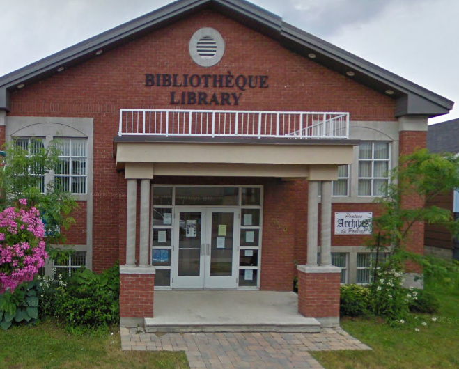
The public bibliothèque (library) and the hôtel de ville (city hall) were clearly labelled in French and English.  

The stop signs were bilingual, and even included this attractive sign underneath to indicate a 4-way stop intersection.  It reminds me of a gingham tablecloth or a quilt pattern.

French & English school busses
When I researched Shawville, I found out that it is not Francophone, as I had expected as soon as I crossed the provincial border.  It is overwhelmingly English-speaking and Protestant, settled in the mid-19th century by Protestant Irish (probably Northern Irish) immigrants.  For decades, the residents have been in conflict with the government of Québec and its language police.  Yes, Québec has language police!  

In 1977, the government of Québec declared that French would be the only official language of the province, and established the Office Québécois de la Langue Française (Québec Office of the French Language).
As summarized by an article in Wikipedia, the fundamental French language rights in Québec are:
1.      The right to have the civil administration, the health services and social services, the public utility enterprises, the professional corporations, the associations of employees and all enterprises doing business in Québec communicate with the public in French.
2.      The right to speak French in deliberative assemblies.
3.      The right of workers to carry on their activities in French.
4.      The right of consumers to be informed and served in French.
5.      The right of persons eligible for instruction in Québec to receive that instruction in French.
This law followed more than a century of English-speaking domination in government and society, it caused quite an upheaval at the time, and there seems to be some belligerence in its enforcement. 

In 1999, an inspector visited the town to photograph business signs that were not in compliance with the language law (French only, or bilingual with French more prominent than English).  Business owners were unwilling to pay for extra signage that did not serve their customers’ needs, and had been receiving notices of violations and fines due.  They were fed up with the harassment.  Several of them confronted the inspector, followed her around, and told her to stop taking pictures.  The mayor even joined the confrontation in support of his constituents, and the inspector did leave town.

Seventeen years later, how are the French-English-speaking relations developing?  How is the Province du Québec fitting into the nation of Canada as a whole?  I was able to read some of the Wikipedia page about Québéc in French!  It made the point that the official language of Québec is “français québécois”, which is distinct from the language of any province in France, because it was influenced by social and commercial interaction with Algonquins in the New World.   This cross-cultural interaction is a point of pride for them, but the invasion of “franglais” (French-English) patois into the province has been resisted by prescriptivist compilers of dictionaries and the language police.

St. Jean Baptiste Day festival
Apparently political separatism is no longer an urgent goal for the Québécois citizens, but they are not generally fans of Canada Day, and many prefer to celebrate their own “national festival” of St. Jean Baptiste a week earlier.

So many discoveries for one day!

info:  Wikipedia.com

images:  Google Street Views

Wednesday, August 3, 2016

Haley Station, Ontario

brackish water of Eadys Lake
2,633 miles

Aug 3 - Highway 17 (and my virtual bike) continues southeast from Muskrat Lake along the straight line of small lakes that were once considered an opportune route for building a canal to avoid the hazardous portion of the Ottawa River that was full of non-navigable rapids.  In this place, Ice Age glaciers carved a dot-to-dot guide for a future canal! (See map: Muskrat Lake

The region is so distinctive that it is named Whitewater Region.  Samuel de Champlain, the “Father of New France”, explored the area in 1613, and this string of lakes has been collectively named Champlain Trail Lakes.  Samuel de Champlain had already named a large lake for himself, the one between the future Vermont and New York.  These smaller local lakes might have been named for his fellow explorers, but the current names are English, so their naming remains a mystery.  Southeast from Muskrat Lake, the string includes:  Astrolabe Lake (more on this later), Olmstead Lake, Jeffreys Lake, Pumphouse Lake, Eadys Lake, Dump Lake, Galilee Lake, Smiths Lake, Blanchards Lake, Garden Lake, Catharine Lake, and Coldingham Lake.  A network of hiking trails connects several of the lakes.

Champlain's astrolabe
In 1867, a local 14-year-old farmboy, Edward Lee, was helping his father clear trees near Green Lake when he found an old astrolabe, a tool for navigation on land.  Edward sold the astrolabe to a steamboat captain (who never paid the promised $10), who sold it to his boss.  

This astrolabe was determined to be likely the same one that Champlain had lost during his 1613 Ottawa River exploration, and eventually it became the property of the Canadian Museum of Civilization.  Green Lake was renamed Astrolabe Lake.


This will be my last stop in Ontario.  I will leave the Trans-Canada Highway at this point, cutting between Pumphouse Lake and Eadys Lake to go east on Chenaux Road, and across the Ottawa River to Quebec!

info: Wikipedia.com

images:  Google Images

Friday, July 29, 2016

Muskrat Lake, Ontario

a tree-filtered glimpse of Muskrat Lake
2,618 miles

whitewater rapids on the Ottawa River
July 29 - The Ottawa River in this area is full of whitewater rapids, so traditional canoe travel was impossible.   

Algonquin family with transport canoe
The native Nibachis, an Algonquin-speaking tribe, and the first French explorers, including Samuel Champlain, followed a 13-mile portage route from east of the Roche Fendu set of rapids, overland to the southeastern end of Muskrat Lake (now Cobden),  and then using the Muskrat River system to continue to Mirimichi (now Pembroke). Later, lumbermen also used this route.  

Muskrat Lake shortcut

The Government of Upper Canada commissioned the famous surveyor and explorer David Thompson to find out whether a canal route was feasible, but did not proceed with that idea.  Then a private entrepreneur, Jason Gould, set out to build “Gould’s Line”, which combined overland and lake travel along that same route.

"corduroy road" of logs

A rough “corduroy road” made of logs was laid out from the lake to the Ottawa River below Calumet Island, along which stage wagons carried freight and passengers.  Row boats on Muskrat Lake conveyed passengers and goods to Pembroke, replaced later by a small steamboat.  When the line was complete in the 1850s, the entire trip – from Ottawa  to Rapides des Joachims and  back – could be accomplished in three days.


Ottawa River steamship, 1868
In 1868, a steamship company published a brochure titled “Tourists and Travelers Guide to the Upper Ottawa” and in 1984 a local historical article, written by Clyde C. Kennedy and published in the Pembroke Observer, summarized the description of this mid-Victorian mode of deluxe travel:

First class omnibuses left the various Ottawa city hotels every morning during the week to connect at Aylmer with steamers leaving the place upon the upward voyage at 8:30 a.m. The passengers enjoyed the novelty of eating each meal during the day on a different vessel. They breakfasted on board the “Ann Sisson” shortly after leaving Aylmer, dined upon the “Alliance” and had tea in the course of the trip from Cobden to Pembroke on the “Jason Gould” or “North Star“.


Around 1916, a cryptid creature was seen in Muskrat Lake, and folktales began circulating about the water monster.  It was described as “having three eyes, three ears, one big fin halfway down its back, two legs, [and] one big tooth in front, is silvery-green in colour, and stretches for twenty-four feet.” It was likened to the Loch Ness Monster of Scotland, and was thus named “Mussie”.

The creature has become a tourist attraction and a cultural mascot of the area, much like Paul Bunyan or Cordwood Pete (March 1 – Fosston, Michigan).  Mussie is portrayed on signs welcoming visitors to Cobden and by a statue (with only 2 eyes) in front of the hardware store in the village.

The statue of Mussie is given seasonal accessories to mark holidays, like reindeer antlers & a Rudolf red nose for Christmas.
Visitors to Muskrat Lake search for Mussie in the lake, but no one has captured evidence of its existence.


Muskrat Lake's ecology encourages the growth of underwater weeds that can entangle swimmers and boat propellers.  Visitors flock to the lake to catch impressive pike, walleye, pickerel, and lake trout, even though eating the fish is not recommended due to high levels of phosphorus and green algae in the water.


info & images:
Wikipedia.org
Google Images

Sunday, July 24, 2016

Forest Lea, Ontario

2,603 miles


July 24 – This crossroads is a “rural community” within an administrative conglomeration of such settlements.  The surrounding woods seem to be full of cross-country ski trails. 


Forest Lea itself seems to be no more than a exurban housing development with a romantic name.  There’s no evidence of a town center or any historical remains.  The large houses seem recently built.  

In my Google Street Views exploration of this crossroad, I found myself following this iconic yellow bus driving on the highway.  The school-age children of Forest Lea are bussed to schools in the Ottawa River-side town of Pembroke.