Thursday, December 31, 2015

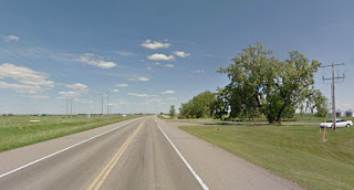
Ernfold, Saskatchewan


Former Lions Club meeting hall
971 miles

Dec 31 - This building indicates a formerly thriving town and the community-building clubs that used to drive democratic civil society. 


Robert S. Pohl describes his 2013 visit to Ernfold on his blog, Saskatchewan Ghost Towns:
http://robertspohl.blogspot.com/2013/06/saskatchewan-ghost-towns.html

Wednesday, December 30, 2015

Herbert, Saskatchewan

Herbert Train Museum
                      958 miles

The old Herbert train station is now a train museum.  On the grounds are three pieces of rolling stock: a snowplow, a caboose and a boxcar.


welcoming sign outside the station

From a sign inside the station:
"Faspa is a coffee-break, tea-time. A coffee and cake time between lunch and supper. Traditionally, Mennonite homes served Faspa on a regular basis. ... Homemade bread, accompanied by butter, jams, and sometimes meat and cheese formed the centerpiece of Faspa. Frequently cakes and cookies followed the bread course... Nowadays Faspa is typically reserved for company on Sunday afternoons. Faspa is not necessarily served because people are hungry or thirsty, but rather as a show of hospitality."

images & info from Steve Boyko's train blog: Confessions of a Train Geek


Tuesday, December 29, 2015

Waldeck, Saskatchewan

Saskatchewan fields with rolls of harvested hay
                            945 miles

Dec 29 - Waldeck is a German word meaning "Wooded Corner", possibly referring to the willows that once grew here along the banks of the Swift Current Creek, or possibly to an immigrant's hometown. 

Monday, December 28, 2015

Swift Current, Saskatchewan

                            932 miles

Dec 29 - Despite strong historical evidence for this name, I could find no images of the creek that show any current at all.  It looks like a stagnant slough.  The official name of the creek comes from the Cree, who called the South Saskatchewan River kisiskâciwan, meaning "it flows swiftly." Fur traders in the 1800s called the creek "Rivière au Courant" (lit: "river of the current").  Modern nicknames for this small city are: "Speedy Creek", "Swift", or "Swifty". 

The longest-running business in Swift Current is the Imperial Hotel.  Built in 1903, it was used as evidence that Swift Current should be granted village status.  The owner needed the designation to obtain a liquor license for the hotel.  The hamlet became a village the next year, and then a town in 1907, when a census indicated a population of 550.  Swift Current became incorporated as a city in 1914.  This swift growth seems characteristic of this area.

info: Wikipedia

Sunday, December 27, 2015

Dec 27 - pedaling hard 13 miles

Dec 27 – 13-mile cycling sessions are hard!  Still hard!  When will I get strong enough to make it more manageable?

Gander Lake, Saskatchewan

                              919 miles

Dec 27 - The sky seems to be the star of this scene.  I’d expect a lot of Canada geese.  Give it a gander.


Saturday, December 26, 2015

child's play: butternuts

Hattie’s 1867 schoolgirl letters

Oct 4:  “I suppose Bell + Herbie are gathering nuts now, if there are any to gather.”

Oct 15:  In a note to her sister Bell:  “The butternuts must be plenty this year according to your account.  Uncle Marshal says tell the boys he will give them .25 per bushel for ten bushels delivered in Rutland.”

Native butternut, also known as white walnut.  The kernel is often caught in the shell cavities, making the meat difficult to remove, but it will usually come out in 2 pieces when cracked from end to end with a hammer or a suitable nut cracker.


Nov 5:  “Have the nuts been in plenty that the garret will not hold them?  The boys have a good many compositions about nutting excursions, but most of them seem rather unsuc[cess]ful in finding many where they have been.”

Gathering butternuts seems to be a common autumn activity for both Bell & Herbie.  If they gather enough, they will be able to sell them to their uncle, so he is encouraging them to be entrepreneurial farmers.  They need to keep them in a dry place, so they lug baskets (buckets?) of them into the attic?


Webb, Saskatchewan

                                          906 miles

Dec 26 - Another once-treasured vehicle left to rust in the snow, but rendered so artistically in this photo.

Webb is called a village, even though it includes only 44 people, because it is incorporated.  It has a mayor, an administrator, and a Village Council.  This looks like a high degree of citizen involvement.


Friday, December 25, 2015

Gull Lake, Saskatchewan

                            893 miles

Dec 25 - Today the main street of the town itself is pictured.  Unlike most other towns located along the Canadian Pacific Railway main line, Gull Lake was not planned and established by the railroad. In fact, there was some animosity from the railroad towards this town that bucked their plan.

The name Gull Lake comes from the Cree word for the area, Kiaskus (kiyaskos) which means "little gull". 

info & image:  Wikipedia

Thursday, December 24, 2015

Tompkins, Saskatchewan

880 miles

Tompkins has this old Sod Hut on display.  What a sensible building method for the prairies!  And there's a Buffalo Bean Museum.

Buffalo bean, also known as golden bean, wet tooth, buffalo flower, & prairie thermopsis, is a hardy perennial native to the North American plains. 

buffalo bean image:  http://www.albertafarmexpress.ca/


Wednesday, December 23, 2015

Piapot, Saskatchewan

867 miles

Dec 23 - This “small village” with a population of 53 is almost a ghost town.  The post office and the Piapot Saloon and Guesthouse (& gift shop), in the style of an old western saloon,  are the only businesses that are open to the public. 

This memorial to the age of steam tractors was created by stacking stones around two obsolete machines.

info: Wikipedia
image:  https://www.flickr.com/

Tuesday, December 22, 2015

Hay Lake, Saskatchewan

854 miles

Dec 22 - Apparently this area is full of muddy hay fields & shallow lakes & ponds.  I found lots of images of hay fields somewhere in Alberta, and lots of shallow lakes, but I couldn’t find any images of Hay Lake or the hay surrounding it.  [no info, no image found]

Monday, December 21, 2015

Maple Creek crossroad, Saskatchewan


841 miles

Dec 21 - The town of Maple Creek is too far off the road for my trip, but here is the crossroad and a farmhouse with pretty wildflowers.


image: Google Street Views

Dec 21 - 13 miles a day?

Dec 21 – 13 miles/day: I’m at the Alberta-Saskatchewan border, ready to try a 13-mile cycling session.  I’ve mapped out my journey in 13-mile segments, so I’m kind of committed now.  I don’t want to take too big a step that could force me to go backward.

Sunday, December 20, 2015

Alberta-Saskatchewan border


Alberta-Saskatchewan border    828 miles (415 US miles + 596 Candian km)
Dec 20 - Cummings Rest Stop:  The town of Cummings has declined and no longer has a school, but it does have this welcoming rest stop named after it.  The sign shows the Saskatchewan slogan: "Saskatchewan Naturally".  As meaningless as most civic slogans, I guess, but possibly a warning about the necessity of living with the natural environment here.  The Canadian and Saskatchewan flags fly straight out in the wind of the Great Plains.

image: Google Street Views

Saturday, December 19, 2015

Irvine, Alberta


Dec 19 – Irvine, AB:  An ornate grave fence in the cemetery for Germans from Russia.  I learned about the history of the “Volga Germans”, who had been welcomed into Russia by Catherine the Great during European religious wars, given privileges of religious freedom and exemption from military service.  Generations later, while these people  still lived separately and maintained their German culture, their privileges were taken away, and many people moved to the American and Canadian Midwest.   Here in Irvine is the St. Georges Parish Cemetery, where blacksmiths used wagon-wheel rims and scrap metal to make ornate grave markers.

info:  Wikipedia & Germans from Russia Heritage Collection

Friday, December 18, 2015

Dunmore, Alberta


Dec 18 – Dunmore, AB:  The grain elevator (photographed) of a hamlet with a high school, a park, and a community center (no photos found).

Thursday, December 17, 2015

Medicine Hat, Alberta

Dec 17 - Medicine Hat, AB:  The giant Saamis Tepee, designed as a symbol for the 1988 Winter Olympics in Calgary, then moved to Medicine Hat.  It seems to defy the stormy weather of these plains.


image: http://www.theweathernetwork.com/
Holly Wright, 20 July 2015

Wednesday, December 16, 2015

Cypress County farmland, Alberta


Dec 16 – The Cypress County landscape is dominated by a shortgrass prairie ecosystem.  The land is flat to slightly rolling.

Cypress County has a semiarid climate with cold, dry winters and warm to hot summers.  The winter cold is occasionally tempered by mild and dry chinook winds blowing from the west.  Hot summer daytime temperatures are made tolerable by low humidity and rapid cooling in the evening hours.

info:  Wikipedia.com

image:  Google Street Views

Tuesday, December 15, 2015

Seven Persons, Alberta

Dec 15 – This hamlet was founded by a few American Mormons in the 19th century.  This was part of a wave of migration of Mormons leaving the United States to find religious freedom, since in 1862 the United States had created laws that did not let them practice polygamy, a part of their religion at the time. 

I was unable to discover whether there were precisely 7 persons involved in founding the community.  Seven men, women, & children could easily be one family.  Or was it 7 men, plus their wives & children?  That could be more like 40 persons.


This view from the highway seems to show a community park picnic pavilion, a hint of community life in this area of vast distances.

info:  Wikipedia.com

image:  Google Street Views

Monday, December 14, 2015

Whitla, Alberta

wintry road of Whitla
Dec 14 – A ghost town.  Homesteading began in 1908.   By 1910 there were: a general store, a lumberyard, a hardware store, a farm machinery firm, a Union Bank, several cafes, and three auto repair shops.  The agricultural decline, and thus the decline of the town, began in the 1920s. 

info:  Wikipedia.com

Sunday, December 13, 2015

Bow Island, Alberta

30-foot tall sunflower sculpture
Dec 13 – One story told about the naming of Bow Island is that the communities of Grassy Lake, approximately 25 km (16 mi) to the west, and Bow Island had their respective names mixed up.  An island named "Bow Island" is located north of Grassy Lake near the confluence of the Bow River and the Oldman River, while a low depression south of the town of Bow Island is named "Grassy Lake".

Bow Island is known for its dry edible bean industry. A 5.5 metre (18 ft) tall statue of the mascot "Pinto MacBean" greets everyone coming into town.  The town also has a replica oil derrick and the “world's largest” golf putter.  In fact, Albertans seem to have a fascination with building giant replicas of ordinary things.  Take a look at Big Things in Alberta.

info: Wikipedia.com

image & more info:   http://www.bigthings.ca/bigab.html

Saturday, December 12, 2015

Burdett, Alberta

grain elevator in Burdett, AB
Dec 12 – Burdett is a hamlet in Alberta, Canada within the County of Forty Mile No. 8.  The County names are so bureaucratically stodgy!  Previously incorporated as a village in 1913, Burdett devolved to hamlet status in 2003.
Burdett is regarded as the site of Canada's first irrigation pivot.

Grain elevators, according to the online Canadian Encyclopedia, “have been variously referred to as prairie icons, prairie cathedrals or prairie sentinels, [and] are a visual symbol of western Canada.”  Apparently there are many nostalgic photographers travelling around and documenting these disappearing landmarks, as well as the farms and railways they served.  Many can be found in John MacDonald’s online collection, Grain Elevators of Western Canada.


Friday, December 11, 2015

Purple Springs, Alberta: grazing & wildflowers

Dec 11 – In searching for the beautiful purple springs of my imagination, I learned about the Purple Springs Provincial Grazing Reserve, the first irrigated reserve in Alberta in 1957.  The goal was to help establish viable farms in the area.  I thought it was an interesting idea of communal responsibility for rural land management.


A 2008 report from Alberta Sustainable Resource Development describes the land and how it is being used:

The reserve is located in the dry mixed grass subregion of the grassland natural region and covers 6,684 acres of level to gently rolling land. There are about 1,100 acres of flood irrigation located in two pastures. One is at Grassy Lake, and the other is at Purple Springs. The St. Mary River Irrigation District and the Taber Irrigation District service these pastures. The remaining 5,584 acres consists of 2,000 acres developed tame pastures and 3,584 acres of native grasslands.
On April 1, 1998, The Purple Springs Grazing Association negotiated a renewable management agreement with the government to assume all aspects of livestock management on the reserve. The management agreement requires the association to maintain the fences, dugouts, corral sites and buildings at the headquarters. Although the reserve is quite small in area, it requires two corral systems because the reserve has two separate parcels, divided by the CPR tracks and Highway No. 3. This makes it impractical to move animals from one parcel to the other.
In 2004, the grazing association began a project to upgrade the flood irrigated fields by replacing open ditches with 1.5 miles of gated pipe.
In a normal year, the reserve can graze 1,300 head of livestock for a five month period from mid-May to mid-October. Red Angus and Charolais breeds are run on the reserve. In 2005 the association started to provide the bulls for the breeding programs.
Fall and winter months provide recreational opportunities for pheasant hunting, cross-country skiing and snowmobiling. Access routes have been provided for those wishing to visit the reserve.


And – finally! – I got a hint about those purple springs. 

Maybe the early explorers & namers saw this area in high summer when some of the low-lying ponds were surrounded by wildflowers in bloom?  My personal nominees for adding purple to the prairies: showy locoweed.


For a catalog of Southern Alberta purple wildflowers, take a look at Wild About Flowers: http://wildaboutflowers.ca/advanced_search_page.php

Purple Springs, Alberta: transcontinental virtual bike trip

Dec 11 – I was really looking forward to seeing images of some beautiful natural springs with purple coloration in the water or the surrounding rocks.  I found no hint of any springs or any justification for this enticing name.  Purple Springs is a hamlet (less than 300 people), and the most interesting picture I found was this Google street view of a large old tree near what was an old farmhouse, and a parked (junked?) car in the grass.

But this image led me to another blogger and virtual traveler, Andrew Dunn, of Vancouver, British Columbia.  He bikes 7 km to & from work, but wanted to turn that commute into a virtual ride across Canada to St. Johns, Newfoundland.  


That’s 8,000 km (4,970 miles) – way farther than my own transcontinental ambitions!  And Andrew needs to deal with the real-life weather & traffic of Vancouver in all seasons.  All of Andrew’s images are from Google Street Views, so they show literally what you could see from the road.


Virtual Trans-Canada Project: https://virtualbikeride.wordpress.com/about/

Thursday, December 10, 2015

Taber, Alberta


          708 miles

Dec 10 – A public skateboarding park seems like an excellent structure for entertaining young people here on this flat prairie.  Taber is famous for its corn due to the large amounts of sunshine the area receives. It is therefore known as the Corn Capital of Canada and holds an annual "Cornfest" in the last week of August.

info:  Wikipedia.com

Wednesday, December 9, 2015

Cranford, Alberta

pivot irrigation equipment
          696 miles

Dec 9 - “This area is not suitable for growing crops,” said surveyor John Palliser in 1863.  While ranching and grazing eventually became common, growing crops was not successful. By the 1930s, this area was a dust bowl.  During World War II, Pacific Coast Japanese-Canadians were sent here to work in the labor-intensive sugar beet fields, using primitive open trench irrigation methods.  Later, pivot irrigation systems made commercial agriculture viable in this area.

Near Cranford is a Hutterite community, called the “Lakeside Bruderhof”, founded in 1935.


Tuesday, December 8, 2015

Coaldale, Alberta


Alberta Birds of Prey Centre
          684 miles

Dec 8 - At the Alberta Birds of Prey Centre, scientists 
     - study & monitor wild birds of prey, 
     - breed & release endangered species, and 
     - rehabilitate & release injured birds of prey back to the wild.

The Coaldale area was called the “Gem of the West” by a visitor soon after irrigation came to the region and revealed the richness of the land. The Gem of the West historical museum is located in the old Mennonite Brethren Congregation church. 

Alberta Birds of Prey Centre: http://www.burrowingowl.com/


Monday, December 7, 2015

Lethbridge, Alberta (Oldman River)

High Level Bridge over Oldman River
     672 miles

Dec 7 - Initially, seeing this river on a map, I thought I had discovered “Old Man River”, but it’s commonly spelled Oldman, so I surmised that it was probably named after a European explorer.  Then I learned that there is also an ancient Blackfoot tale about the “Old Man” who created the earth from mud, and those who use the “Old Man” spelling are honoring that tradition.  Of course, either spelling can refer respectfully to the mythical creator.  It's possible that his original name was too sacred to tell to strangers, much like "Yahweh".  In the late 1980s, traditionalist tribal leaders resisted building a dam on this sacred river of creation.

Lethbridge is the commercial, financial, transportation and industrial center of southern Alberta. The city's economy developed from drift mining for coal in the late 19th century and agriculture in the early 20th century.

The High Level Bridge, built in 1912, is the world’s longest and highest rail trestle bridge in the world.  It is an amazing engineering achievement, but has been the site of many suicidal jumpers.


info: Wikipedia.com

Sunday, December 6, 2015

Monarch, Alberta

          660 miles

Dec 6 – Monarch is a hamlet of about 220 people living in 90 homes.  This poignant picture of the former café-tavern-hotel inspired me to want to learn more about each town I (virtually) visit, to do justice to the lives of the people who really live there. 

A hamlet, in the province of Alberta, is an unincorporated community administered by a “rural municipality”.  It consists of five or more dwellings, has a generally accepted boundary and name, and contains parcels of land used for non-residential purposes.

A hamlet can be incorporated as a village when its population reaches 300.  However, according to Wikipedia, Alberta has not had a hamlet incorporate as a village in over 30 years.  Since 1980, “it has been more common for urban municipalities to dissolve from their current municipal status to that of a hamlet under the jurisdiction of its surrounding specialized or rural municipality.”  More ghost towns with hints of former glory.

info: Wikipedia.com

Saturday, December 5, 2015

Range Rd 251, Ft. McLeod, Alberta

Dec 5 - I’m trying to get the lay of the land as I descend from the Rocky Mountains.  I’ll be entering the uplands Missouri Plateau that stretches across the southeast corner of Alberta and the southwest corner of Saskatchewan, as well as across the Great American Desert of the upper Missouri River, especially Montana & the Dakotas.   Historically, this region was considered unsuitable for agriculture.  The terrain of the Missouri Plateau features low hummocky, undulating, rolling hills, potholes, and grasslands.

Fort MacLeod Historical Museum
Although my route doesn’t take me directly to this old fort, it hints at some historical context for the area. 

info:  Wikipedia.com

Dec 5 - increase mileage? speed?

Dec 5 – I’m doing 12 miles/day comfortably now.  I’m looking ahead to the Great Plains on the map, and seeing such vast distances between towns.  If I’ m able to do 13 miles/day across Saskatchewan, I could reduce the number of days I spend there.  But I remember how difficult it was to increase to 12 miles/day.  I don’t want to set a target that’s too difficult to sustain.  So, while I’m still “in” Alberta, I will try to increase my speed, and then see if I’m ready to increase my cycling stints at the provincial border.

Friday, December 4, 2015

Stowe, Alberta

Buffalo Jump
Dec 4 - A town name from Vermont, but this is very different in terrain, climate, history, etc.
This cliff is called Buffalo Jump, because the native peoples used to chase buffalo over the cliff to kill & then butcher them.  This is the first mention I’ve seen of any indigenous peoples.  I wonder about what tribes, what history, what modern presence they have?


Thursday, December 3, 2015

Wednesday, December 2, 2015

Cowley, Alberta


Dec 2 – What an interesting juxtaposition of the sturdy old barn against the new wind turbines.  It’s truly a “wind farm”.


Tuesday, December 1, 2015

Lundbreck Falls, Alberta

Dec 1 – The Rocky Mountain foothills of western Alberta are full of spectacular waterfalls!  This beautiful waterfall near the town Lundbreck has not even been included in many lists.  According to the World Waterfall Database, it has not been officially named, measured, or categorized yet.  I’m happy to be able to enjoy it here.


Friday, November 27, 2015

Nov 27 - cooling off the gym

Nov 27 – The temperature outside is cold enough to start up the furnace, and make it work hard enough to warm up my exercise room.  So wrong!  I closed off the heater vent, and now it’s so cold that I start my warm-up phase wearing a winter scarf around my neck & shoulders.  (Remember the high-speed fan giving me a tail breeze during exertion?)

Friday, October 23, 2015

McCarteney Creek, Washington

164 miles

Oct 23 – What looked like a creek on the map – a named creek! – looks more like a dip in the dry scrub.  A nursery for future tumbleweed.

Thursday, October 22, 2015

creek bed crossing, Washington

153 miles


Oct 22 –  There’s not much to see here.  No farmhouse, no crossroad, no rocky outcropping, no flowing river or inspiring bridge.  Just a fairly dry creek bed to mark the spot on the road where I will stop for the night.

Wednesday, October 21, 2015

Waterville, Washington

142 miles

Oct 21 – Columns of basalt are visible from the highway along the Columbia River. 


Waterville was named for having the only water-producing well for many miles around, but it is famous for its wheat production & crop circles.  I think crop circles are a sign of clever young people without enough fulfilling creative outlets.  

Tuesday, October 20, 2015

Lincoln Rock, Washington

131 miles


Oct 20 – This craggy cliff face looks something like a profile of Abraham Lincoln if you see it from the right angle.  And the best place to see it is from across the Columbia River at the Lincoln Rock State Park.  The park offers facilities for picnicking, camping, & hiking, as well as fishing, boating, & swimming.  I can go to sleep tonight imagining that I am tucked up snug in my imaginary camper.  Or, as long as it’s a virtual experience, I could sleep out under the stars to see Abe across the river.

Monday, October 19, 2015

Monitor, Washington

120 miles


Oct 19 – The road into Monitor seems grim and depressing.  I guess that’s the downside of judging a place from just one photo.  Monitor is a very small town (342 people), and the most interesting thing I can find out about is the name.  In 1902, the citizens named it after the ironclad warship USS Monitor, the famous Union battleship in the Civil War.  It’s interesting that people in the West would choose to honor that particular heritage 40 years after the war.  The citizens involved in the decision may have been veterans or children of Union sailors on that warship. 

Sunday, October 18, 2015

Leavenworth, Washington

109 miles

Oct 18 - Visible from the roadside: Drury Falls: Such an exciting 2-star horsetail falls!


In the 1970s, this mountain town adopted a Bavarian-style theme to attract tourists.  What a success!  Every season, on almost every weekend, it seems, they host a different festival of some sort.  Since I spent part of my childhood in Germany, I love the Bavarian-style food, architecture, & wood carvings, however contrived.